


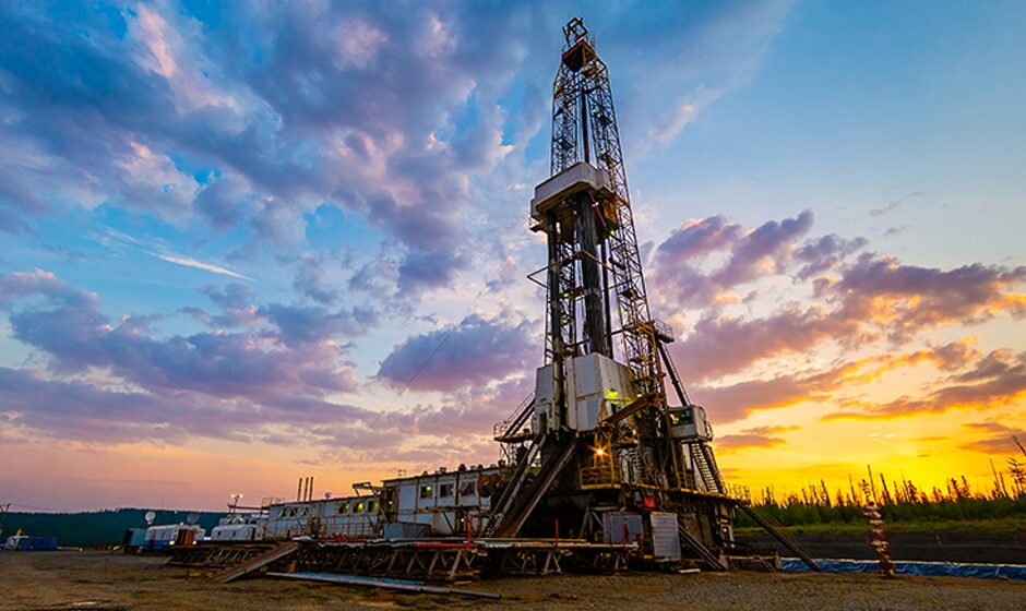
Seismic surveying has been an intrinsic part of oil and gas development, being used in both exploration and production, and it is set to become even more critical as the need for more accurate information and more sustainable operations grows.
Along with identifying prospective oil and gas reservoirs, seismic techniques are also used to support carbon capture and storage (CCS) project development, from the early site assessment phase through to ongoing monitoring once operational, and is essential for characterising CCS reservoir properties and estimating potential storage capacities.
Seismic data can be acquired through different methods, with the three most common being two-, three-, and four-dimensional (4D) surveying. As the simplest and most cost-effective method, 2D seismic involves sending sound waves along a single line and is typically used for exploration in relatively flat areas. For a more detailed and accurate image of the subsurface, 3D seismic is the most suitable choice – it is often necessary in areas with complex geology and it involves sending sound waves in a grid pattern.
Repeating 3D surveys over a period of time – referred to as 4D seismic – is typically used to monitor changes in the subsurface due to production or natural processes, and can help optimise production. Advancements in seismic technology include high-frequency seismic imaging, full-waveform inversion (FWI) techniques, multi-component seismic imaging, and distributed acoustic sensing (DAS) technology.
High-frequency imaging improves the resolution of subsurface images by using higher frequency sound waves, which enable smaller geological features and rock fractures to be detected. It is most useful in unconventional reservoirs where it is important to accurately identify the most productive drilling locations.
FWI techniques involve considering entire waveforms instead of simplified representations, which enables the generation of higherquality imaging; however, compared to conventional methods, FWI requires substantial computational power. Multi-component seismic imaging makes use of both P-wave and S-wave data, rather than just P-wave from traditional methods, and provides comprehensive information about subsurface properties such as fluid content and rock anisotropy.
DAS technology, a relatively recent development, uses fibre-optic cables as sensors to capture acoustic signals along the entire length of the cable. This allows for continuous monitoring and has applications in hydraulic fracturing and reservoir surveillance.
Energy transition to drive demand for seismic data
The federal government recently released its medium- and longterm Future Gas Strategy, which highlights the importance of securing affordable gas as Australia transitions towards a more renewable grid, as well as for maintaining its reputation as a reliable energy exporter. Gas is a fundamental resource for multiple sectors of the economy, including manufacturing, food processing and the refining of metals and minerals – it currently supplies about 27 per cent of Australia’s energy needs and accounts for 14 per cent of export income.
The government has acknowledged how gas can help firm up renewable power generation until capacity is increased, particularly for hard-to-abate sectors like manufacturing and mineral processing where viable alternatives are yet to be developed and deployed. Two of the six key principles detailed in the strategy – keeping gas affordable throughout the transition to net zero and finding new sources of supply to meet demand – aim to boost continued gas exploration and development, with a focus on optimising existing resources and infrastructure in producing basins.
Another area of focus is growing Australia’s CCS capacity, which requires significant progress on the identification of geological storage sites, as well as the development of infrastructure. Repurposing existing seismic data that was originally collected for oil and gas exploration has been beneficial for CCS developers, as it eliminates the need for new surveys, providing both cost savings and operational efficiencies.
However, as the original surveys targeted deeper areas containing hydrocarbons, they are not necessarily optimised to overcome some of the challenges presented by CCS. Seismic analysis is used in CCS projects to identify traps and seals, which are crucial components for securely containing and trapping injected carbon dioxide. It is also used to estimate storage capacity, monitor reservoir integrity, provide risk assessment and mitigation, and achieve regulatory compliance.
The three main types of sites ideal for underground carbon dioxide storage are depleted oil and gas reservoirs, deep saline reservoirs, and un-mineable coal seams. Key to their suitability is whether the targeted sites have an overlying impermeable caprock to prevent injected carbon dioxide from leaking into overlying formations, such as underground sources of drinking water.
Seismic imaging enables detailed evaluation of caprock integrity, allowing decision-makers to assess the sealing capacity of potential storage formations. Furthermore, new innovations such as 4D seismic surveys are proving to be vital for CCS projects, as they can offer insights into the movement and distribution of carbon dioxide and identify any potential issues or leaks.